Ball’s Falls
Ball’s Falls
Lincoln, Ontario

Binbrook
Binbrook
Binbrook, Ontario

Chippawa Creek
Chippawa Creek
Wellandport, Ontario

Long Beach
Long Beach
Wainfleet, Ontario

Rockway
Rockway
Lincoln, Ontario
Beamer Memorial
Beamer Memorial
Grimsby, Ontario
Binbrook Tract
Binbrook Tract
Binbrook, Ontario
Canborough
Canborough
Dunnville, Ontario
Cave Springs
Cave Springs
Lincoln, Ontario
Comfort Maple
Comfort Maple
Fenwick, Ontario
E.C. Brown
E.C. Brown
Welland, Ontario
Gainsborough
Gainsborough
Fenwick, Ontario
Gord Harry Trail
Gord Harry Trail
Port Colborne, Ontario
Hedley Forest
Hedley Forest
Haldimand, Ontario
Humberstone Marsh
Humberstone Marsh
Port Colborne, Ontario
Jordan Harbour
Jordan Harbour
Lincoln, Ontario
Morgan’s Point
Morgan’s Point
Wainfleet, Ontario
Mountainview
Mountainview
Beamsville, Ontario
Mud Lake
Mud Lake
Port Colborne, Ontario
Port Davidson
Port Davidson
West Lincoln, Ontario
Ruigrok Tract
Ruigrok Tract
Haldimand, Ontario
Shriners Creek
Shriners Creek
Niagara Falls, Ontario
Smith Ness
Smith Ness
Niagara Falls, Ontario
St. Johns
St. Johns
Fonthill, Ontario
Stevensville
Stevensville
Fort Erie, Ontario
Two Mile Creek
Two Mile Creek
Niagara-on-the-Lake, Ontario
Virgil
Virgil
Virgil, Ontario
Wainfleet Bog
Wainfleet Bog
Wainfleet, Ontario
Wainfleet Wetlands
Wainfleet Wetlands
Wainfleet, Ontario
Willoughby Marsh
Willoughby Marsh
Niagara Falls, Ontario
Woolverton
Woolverton
Grimsby, Ontario
Comfort Maple
Winter Weather Notice
Winter Weather Notice: January 2, 2026
During winter storm conditions, NPCA conservation areas including trails, facilities, and parking lots may not be maintained immediately. Some facilities may be required to close and programs or events may be cancelled or postponed.
Maintenance activities such as parking lot plowing and site servicing occur on an as‑required, priority‑based schedule, and significant delays should be expected during active storm conditions and after heavy snowfall.
For public safety, visitors are strongly discouraged from accessing conservation areas during storms or when other adverse conditions are present. Facilities including trails, pathways, and parking areas may remain snow‑covered, icy, and unmaintained until it is safe for staff to begin winter operations.
Visitors should monitor forecasts and follow alerts, warnings and recommendations issued by Environment Canada.
Please plan accordingly and consider postponing your visit during winter weather events.
Please visit npca.ca for more information, or check NPCA conservation area pages on Facebook for closure postings, as these are updated regularly.
Conservation areas remain open daily from sunrise to sunset for passive winter recreation such as hiking and birdwatching. However, note that natural trails are not groomed for winter recreation such as cross-country skiing, and parking lots and sidewalks will be maintained on a ‘as-required’ basis.
Visitors are reminded to take precaution and prepare appropriately for the weather and trail conditions, especially when inclement weather and conditions may arise. In the event of inclement weather, NPCA conservation areas remain open, but activities and services may be limited and facilities may be closed. Please expect maintenance delays in the event of heavy snowfall.
Check NPCA conservation area pages on Facebook for closure postings, as these are updated regularly.
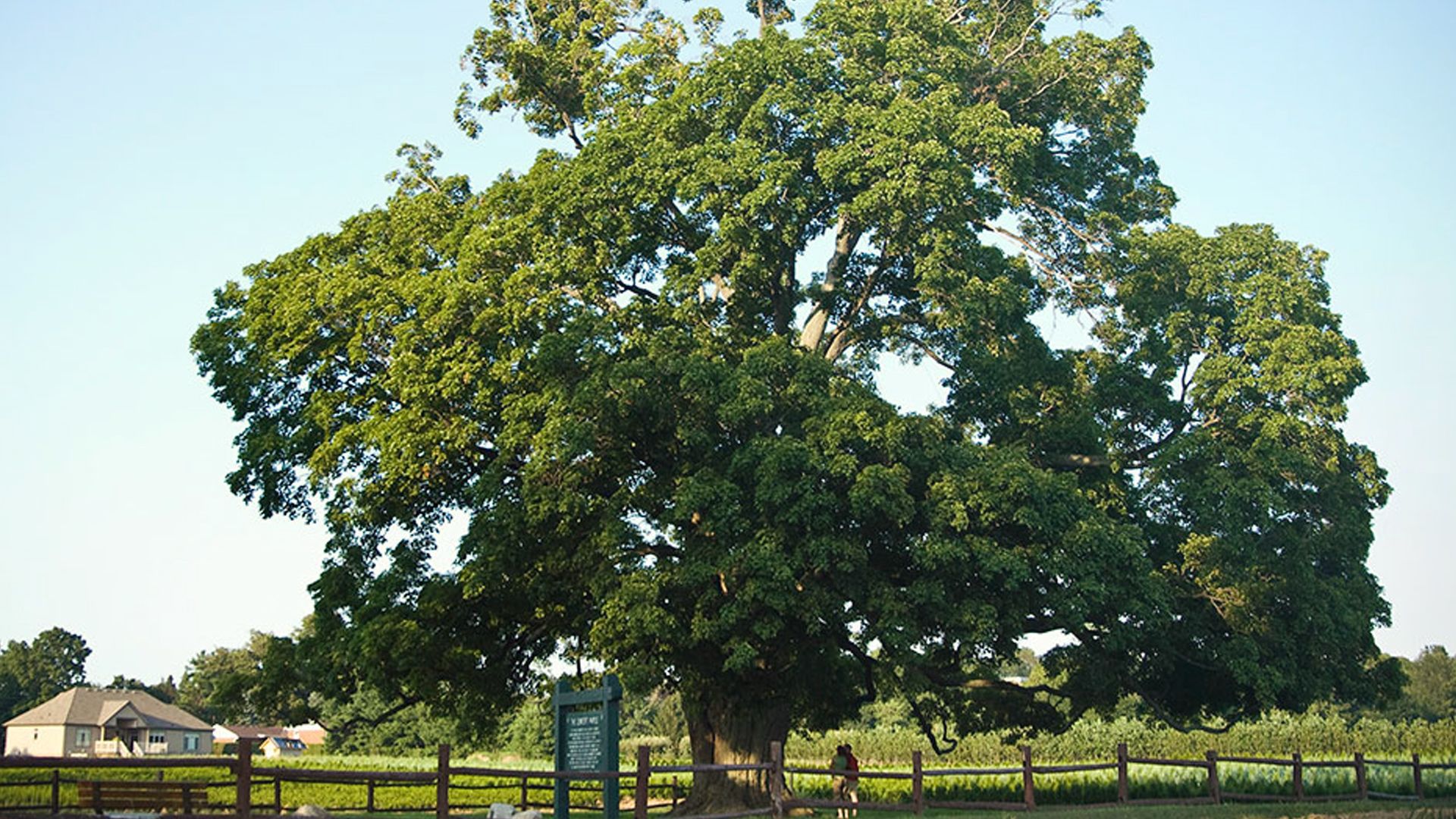
The Comfort Maple Conservation Area conserves what is widely believed to be the oldest and finest sugar maple tree in Canada, which was designated a heritage tree in June 2000 under the Ontario Heritage Act.
In 1975, the Ontario Forestry Association estimated the tree to be 400-500 years old. Located in the Town of Pelham, the Comfort Maple towers about 24.4 metres at its crown with a trunk circumference of 6 meters and symbolizes Canada’s strength and tradition.
Originally in an area of hardwood forest, this tree’s size and shape suggest the forest was cleared when the tree was still young, likely for agricultural purposes. The 0.2-hectare area was part of the land purchased by the Comfort family in 1816 and was later entrusted to the NPCA to conserve this ‘old growth’ tree for its historical and biological significance.
