
Ball’s Falls
Ball’s Falls
Lincoln, Ontario
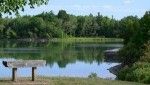
Binbrook
Binbrook
Binbrook, Ontario
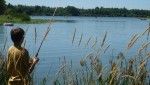
Chippawa Creek
Chippawa Creek
Wellandport, Ontario

Long Beach
Long Beach
Wainfleet, Ontario
Rockway
Rockway
Lincoln, Ontario
Beamer Memorial
Beamer Memorial
Grimsby, Ontario
Binbrook Tract
Binbrook Tract
Binbrook, Ontario
Canborough
Canborough
Dunnville, Ontario
Cave Springs
Cave Springs
Lincoln, Ontario
Comfort Maple
Comfort Maple
Fenwick, Ontario
E.C. Brown
E.C. Brown
Welland, Ontario
Gainsborough
Gainsborough
Fenwick, Ontario
Gord Harry Trail
Gord Harry Trail
Port Colborne, Ontario
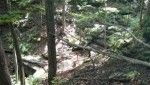
Hedley Forest
Hedley Forest
Haldimand, Ontario
Humberstone Marsh
Humberstone Marsh
Port Colborne, Ontario
Jordan Harbour
Jordan Harbour
Lincoln, Ontario
Morgan’s Point
Morgan’s Point
Wainfleet, Ontario
Mountainview
Mountainview
Beamsville, Ontario
Mud Lake
Mud Lake
Port Colborne, Ontario
Port Davidson
Port Davidson
West Lincoln, Ontario
Ruigrok Tract
Ruigrok Tract
Haldimand, Ontario
Shriners Creek
Shriners Creek
Niagara Falls, Ontario
Smith Ness
Smith Ness
Niagara Falls, Ontario
St. Johns
St. Johns
Fonthill, Ontario
Stevensville
Stevensville
Fort Erie, Ontario
Two Mile Creek
Two Mile Creek
Niagara-on-the-Lake, Ontario
Virgil
Virgil
Virgil, Ontario
Wainfleet Bog
Wainfleet Bog
Wainfleet, Ontario
Wainfleet Wetlands
Wainfleet Wetlands
Wainfleet, Ontario
Willoughby Marsh
Willoughby Marsh
Niagara Falls, Ontario
Woolverton
Woolverton
Grimsby, Ontario